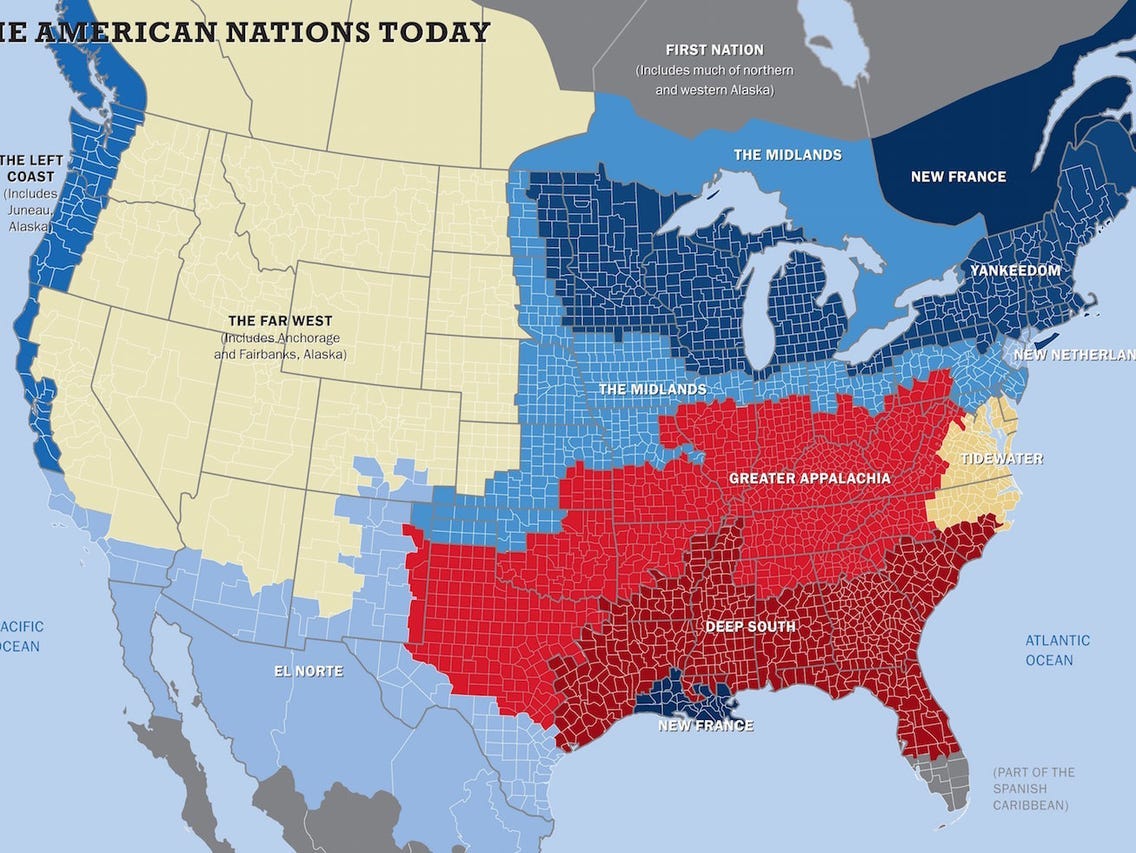
Two maps explain everything about America's unequal response to the coronavirus pandemic

The above one is from the Times. All the red parts show people who continue to travel despite the pandemic. The not-red parts show people who are sheltering in place.
The below map is from Colin Woodard’s American Nations: A History of the Eleven Rival Regional Cultures of North America. The red parts of the first map line up (mostly) with the red parts of his map, which shows “Greater Appalachia” and “Deep South.”
They line up for ideological as well as geographical reasons.
In Woodard’s telling, “Deep South” was “established by slave lords from English Barbados as a West Indies-style slave society. Modeled on slave states of the ancient world — democracy was the privilege of the few. Fights for rollbacks of federal power, taxes on capital and the wealthy, and environmental, labor and consumer protections.”
“Greater Appalachia,” meanwhile, was settled by immigrants “from war-ravaged Ulster, northern England, lowland Scotland. Deep commitment to personal sovereignty and individual liberty; intense suspicion of external authority.”
Both regions are hostile toward federal power. Both regions have little or no tradition valuing the common good. Both appear to be a liability during a national emergency.

I’ll have more to say about this tomorrow. Meanwhile, please consider becoming a paying subscriber to the Editorial Board. Every day, I write an essay in plain English for the common good. This is my job. This is what I do. Please join me today or ….
Many thanks! —John Stoehr
